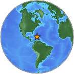
 An earthquake with magnitude 3.2 mg has occurred in 77 km NNE of Punta Cana, Dominican Republic. Time of event: Saturday 20th September @ 4:58 am. Location of event: -68.1435S, 19.2346W, depth=41 km. Read more about the earthquake, Seismometer information, Date-Time, Location, Distances, Parameters and details about quake recorded in: 77 km NNE of Punta Cana, Dominican Republic. Did you feel it? Leave a comment or report about shaking, activity and damage at your home, city and country.
More information
| Parameter | Value | Description |
|---|---|---|
| Magnitude | 3.2 mb | The magnitude for the event. |
| Longitude | -68.1435° West | Decimal degrees longitude. Negative values for western longitudes. |
| Latitude | 19.2346° North | Decimal degrees latitude. Negative values for southern latitudes. |
| Depth | 41 km | Depth of the event in kilometers. |
| Place | 77km NNE of Punta Cana, Dominican Republic | Textual description of named geographic region near to the event. This may be a city name, or a Flinn-Engdahl Region name. |
| Time | 2014-03-17 12:55:01 | Time when the event occurred. UTC/GMT |
| Updated | 2014-03-17 13:54:21 | Time when the event was most recently updated. UTC/GMT |
| Timezone offset | -300 | Timezone offset from UTC in minutes at the event epicenter. |
| Felt | 0 | The total number of felt reports |
| CDI | 1 | The maximum reported intensity for the event. |
| MMI | The maximum estimated instrumental intensity for the event. | |
| Alert Level | The alert level from the PAGER earthquake impact scale. Green, Yellow, Orange or Red. | |
| Review Status | REVIEWED | Indicates whether the event has been reviewed by a human. |
| Tsunami | This flag is set to "1" for large events in oceanic regions and "0" otherwise. The existence or value of this flag does not indicate if a tsunami actually did or will exist. | |
| SIG | 158 | A number describing how significant the event is. Larger numbers indicate a more significant event. |
| Network | pr | The ID of a data contributor. Identifies the network considered to be the preferred source of information for this event. |
| Sources | pr | A comma-separated list of network contributors. |
| Number of Stations Used | 15 | The total number of Number of seismic stations which reported P- and S-arrival times for this earthquake. |
| Horizontal Distance | 0.75009326 | Horizontal distance from the epicenter to the nearest station (in degrees). |
| Root Mean Square | 0.4 sec | The root-mean-square (RMS) travel time residual, in sec, using all weights. |
| Azimuthal Gap | 270 | The largest azimuthal gap between azimuthally adjacent stations (in degrees). |
| Magnitude Type | Md | The method or algorithm used to calculate the preferred magnitude for the event. |
| Event Type | earthquake | Type of seismic event. |
| Event ID | pr14076002 | Id of event. |
| Event Code | 14076002 | An identifying code assigned by, and unique from, the corresponding source for the event. |
| Event IDS | pr14076002 | A comma-separated list of event ids that are associated to an event. |
Leave a Reply