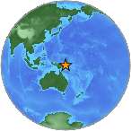
 A light earthquake magnitude 4.6 (mg/mb) was reported Sunday, 111 kilometers (69 miles) from Kokopo in Papua New Guinea. The temblor was reported at 02:30:39 / 2:30 pm (local time epicenter) at a depth of 42.35 km (26 miles). Global time of event 2014-10-12 04:30:39 UTC/GMT. A tsunami warning has not been issued, according to the U.S. Geological Survey. Exact location of event, longitude 152.0571 East, latitude -5.3424 South, depth 42.35 km.
Did you feel it?
Leave a comment or report about shaking, activity and damage at your home, city and country. Read more about the earthquake, Seismometer information, Date-Time, Location, Distances, Parameters and details about quake recorded in: 111 km SSW of Kokopo, Papua New Guinea.
Leave a Reply