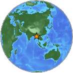
 A light earthquake magnitude 4.6 (mg/mb) has striked on Wednesday, 74 kilometers (46 miles) from Saiha in India. The temblor was reported at 10:42:02 / 10:42 pm (local time epicenter) at a depth of 56.4 km (35 miles). Global time of event 2014-12-31 04:12:02 UTC/GMT. A tsunami warning has not been issued, according to the U.S. Geological Survey. Exact location of event, longitude 93.3057 East, latitude 21.89 North, depth 56.4 km.
Close countries, India (c. 1 173 108 000 pop), Myanmar (c. 53 414 000 pop). The epicenter was 75 km (46 miles) from Saiha (c. 22 700 pop), 90 km (56 miles) from Hakha (c. 20 000 pop). Nearest city, towns to epicentrum/hypocenter was Hakha, Saiha.
Did you feel it?
Leave a comment or report about shaking, activity and damage at your home, city and country. Read more about the earthquake, Seismometer information, Date-Time, Location, Distances, Parameters and details about this quake, recorded in: 74 km SSE of Saiha, India.
Leave a Reply