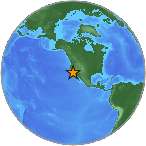
 A minor earthquake magnitude 2.6 (mg/mb) has occurred on Saturday, 0 kilometers (0 miles) from La Habra in California. The temblor was reported at 11:59:55 / 11:59 am (local time epicenter) at a depth of 1.1 km (1 miles). Global time of event 2015-01-17 07:59:55 UTC/GMT. A tsunami warning has not been issued, according to the U.S. Geological Survey. Exact location of event, longitude -117.9521667 West, latitude 33.9256667 North, depth 1.1 km.
Close countries, United States (c. 310 233 000 pop). The epicenter was 30 km (19 miles) from Los Angeles (c. 3 792 600 pop), 28 km (17 miles) from Long Beach (c. 462 300 pop), 11 km (7 miles) from Anaheim (c. 336 300 pop), 21 km (13 miles) from Santa Ana (c. 324 500 pop), 51 km (32 miles) from Riverside (c. 303 900 pop). Nearest city, towns to epicentrum/hypocenter was Santa Clarita, Palmdale, Sun City.
Did you feel it?
Leave a comment or report about shaking, activity and damage at your home, city and country. Read more about the earthquake, Seismometer information, Date-Time, Location, Distances, Parameters and details about this quake, recorded in: 0 km SW of La Habra, California.
Leave a Reply