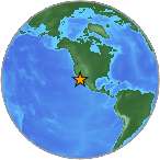
 A light earthquake magnitude 4.89 (mg/mb) has occurred on Sunday, 88 kilometers (55 miles) from Maneadero in B.C. in Mexico. The temblor was reported at 05:45:02 / 5:45 pm (local time epicenter) at a depth of 1.86 km (1 miles). Global time of event 2015-02-09 01:45:02 UTC/GMT. A tsunami warning has been issued near Maneadero in B.C. in Mexico, according to the U.S. Geological Survey. Exact location of event, longitude -115.6653366 West, latitude 31.5261669 North, depth 1.86 km.
Close countries, Mexico (c. 112 469 000 pop). The epicenter was 96 km (60 miles) from Ensenada (c. 256 600 pop), 100 km (62 miles) from Guadalupe Victoria (c. 18 200 pop), 89 km (55 miles) from Rodolfo Sánchez Taboada (c. 17 900 pop), 96 km (60 miles) from San Felipe (c. 15 400 pop), 94 km (58 miles) from Vicente Guerrero (c. 12 800 pop). Nearest city, towns to epicentrum/hypocenter was Delta, Guadalupe Victoria, Ciudad Coahuila (Kilómetro Cincuenta y Siete).
Did you feel it?
Leave a comment or report about shaking, activity and damage at your home, city and country. Read more about the earthquake, Seismometer information, Date-Time, Location, Distances, Parameters and details about this quake, recorded in: 88 km ESE of Maneadero, B.C., Mexico.
Gaylene
i was outside and did not notice, but neighbours in RV park in El Centro, California felt the couch move in their RV and others sitting having camp fire also felt the tremor.