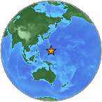
 A light earthquake magnitude 4.8 (mg/mb) was reported Wednesday, 156 kilometers (97 miles) from JP Tinian Town pre-WW2 in Northern Mariana Islands. The temblor was reported at 00:15:43 / 12:15 am (local time epicenter) at a depth of 43.68 km (27 miles). Global time of event 26/05/15 / 2015-05-26 14:15:43 / May 26, 2015 @ 2:15 pm UTC/GMT. A tsunami warning has not been issued, according to the U.S. Geological Survey. Exact location of event, longitude 146.7818 East, latitude 14.1165 North, depth 43.68 km, unique identifier, us10002c6c. Ids that are associated to the event, ,us10002c6c,.
Did you feel it?
Leave a comment or report about shaking, activity and damage at your home, city and country. Read more about the earthquake, Seismometer information, Date-Time, Location, Distances, Parameters and details about this quake, recorded in: 156 km SE of JP Tinian Town pre-WW2, Northern Mariana Islands.
Leave a Reply