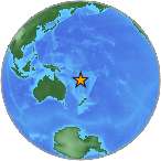
 A earthquake magnitude 6.1 (ml/mb) has occurred on Tuesday, 205 km W of Ile Hunter, New Caledonia (127 miles). The temblor was detected at 06:31:37 / 6:31 am (local time epicenter). Exact location of event, longitude 170.0855 East, latitude -22.0605 South, depth = 10 km. Exact time and date of event in UTC/GMT: 10/09/18 / 2018-09-10 19:31:37 / September 10, 2018 @ 7:31 pm. The epicenter was at a depth of 10 km (6 miles). Id of earthquake: us2000hc1x. Event ids that are associated: pt18253001, at00peuu8u, us2000hc1x. A tsunami warning has been issued near Ile Hunter in New Caledonia (Does not indicate if a tsunami actually did or will exist).
Every year there are an estimated 135 earthquakes in the world. Earthquakes 6.0 to 6.9 may cause a lot of damage in very populated areas. In the past 24 hours, there have been two, in the last 10 days six, in the past 30 days twenty-one and in the last 365 days sixty-three earthquakes of magnitude 3.0 or greater that have been detected in the same area.
Did you feel the quake?
What was your situation during the earthquake? Leave a comment or report about damage, shaking and activity at your home, city and country. Read more about the earthquake, Location, Distances, Seismometer information, Date-Time, Parameters and details about this quake, reported near: 205 km W of Ile Hunter, New Caledonia. This information comes from the USGS Earthquake Notification Service.
Copyright © 2018 earthquakenewstoday.com All rights reserved.
Leave a Reply